

10 Common Compatibility Issues with GPS Positioning and Management Platforms Customized by Chinese Companies for Overseas Clients
2026-03-29 Click:284
Over these years, while working on GPS locator and tracking software OEM&ODM projects for overseas clients, I have observed a recurring phenomenon: many teams initially focus their efforts on whether "the device works" or if "the platform features are sufficient." However, once the project is actually up and running, the issues invariably converge on a more fundamental aspect—compatibility.
Compatibility, in this context, entails more than just a device being able to connect to a platform; it refers to the ability of multiple dimensions—including devices, networks, communication protocols, mapping services, time zones, SIM cards, and data structures—to work together stably and harmoniously over the long term.
Many GPS tracking management platforms customized by Chinese companies pass domestic testing without any problem, but once deployed overseas, they begin to exhibit "all manner of abnormal": device online rates declining, garbled of playback tracking data, erroneous status, data latency, and more. While these issues may appear disparate on the surface, they all stem from a common underlying cause: inadequate compatibility design. The following 10 issues are the ones I have encountered most frequently in overseas GPS projects—and the ones where teams are most prone to stumbling.
Incomplete Communication Protocol Compatibility
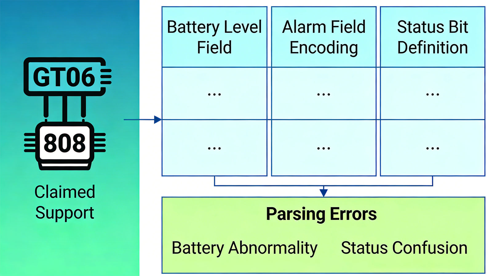
Many platforms claim to support protocols such as GT06 and 808; however, in reality, they perform only "basic parsing" and do not fully cover the protocol variations introduced by different manufacturers. Even within the GT06 standard, different manufacturers often implement distinct extension fields—for instance:
- The position of the battery level field varies;
- The encoding of alarm fields differs;
- The definitions of status bits vary.
If the platform has not been specifically adapted to accommodate these variations, errors will occur during data parsing—such as anomalous battery readings or garbled status information.
Time Zone Handling Errors
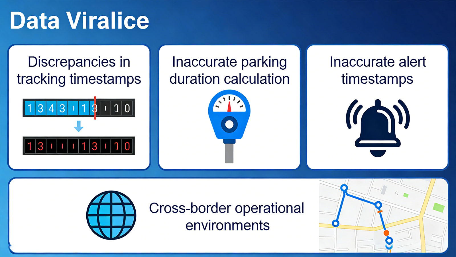
Data uploaded by GPS devices is typically in UTC; however, the platform requires this data to be converted and displayed in local time. Many platforms fail to account for multiple time zones during the design phase—or simply default to using the server's system time—resulting in the following issues:
- Discrepancies in tracking timestamps
- Inaccurate calculation of parking durations
- Inaccurate timestamps for alerts and alarms
This issue becomes particularly pronounced in cross-border operational environments.
Inaccurate Map Matching
Many Chinese companies GPS system platforms default to using Baidu, Gaode, etc, mapping services; however, when utilized overseas, they switch to Google Maps or other international providers. Since different mapping services employ distinct road data structures, if a platform's trajectory-matching algorithm has not been properly adapted, it frequently results in issues such as:
- Vehicles appearing to be positioned alongside the road
- Trajectory drift
- Inconsistent driving routes
These anomalies are particularly pronounced within complex urban road networks.

SIM Card Network Differences
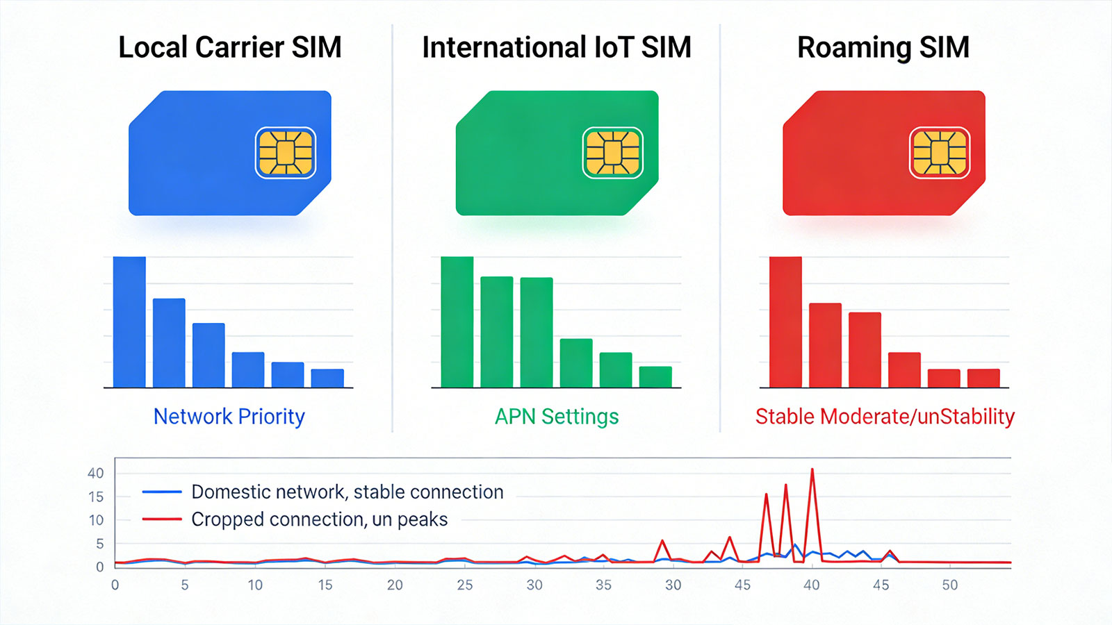
In overseas projects, the types of SIM cards utilized by devices are highly diverse, including:
- Local carrier SIMs
- International IoT SIMs
- Roaming SIMs
These various SIM cards differ significantly in terms of network priority, APN settings, and connection stability. Many platforms are tested using stable domestic networks; however, once switched to overseas SIM cards, they frequently encounter issues such as dropped connections or connection latency.
Inadequate Handling of Weak Network Environments
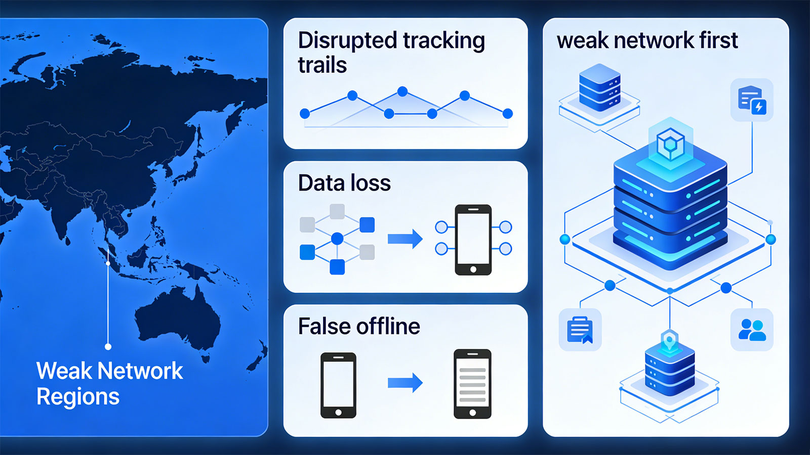
In many overseas regions—particularly in Africa, Southeast Asia, and parts of South America—weak network connectivity is the norm. If a platform lacks built-in mechanisms for offline data resubmission and data caching, the following issues will inevitably arise:
- Disrupted tracking trails
- Data loss
- "False offline" device status
A truly mature platform is invariably designed with a "weak network first" philosophy, rather than being optimized solely for "ideal network conditions."
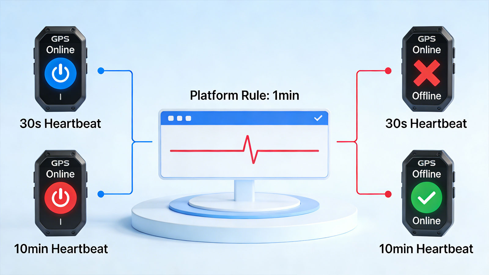
Inconsistent Device Heartbeat Mechanisms
Different GPS trackers employ different heartbeat strategies. Some devices send a heartbeat every 30 seconds, while others may send it only every few minutes or even longer. If the platform applies a single, fixed rule to determine online status, it is highly prone to misclassification. For instance:
- Device may be online but erroneously flagged as offline.
- Device may have lost its connection, yet the platform continues to display it as online.
Such discrepancies can lead to significant operational issues within a GPS tracking and management system.
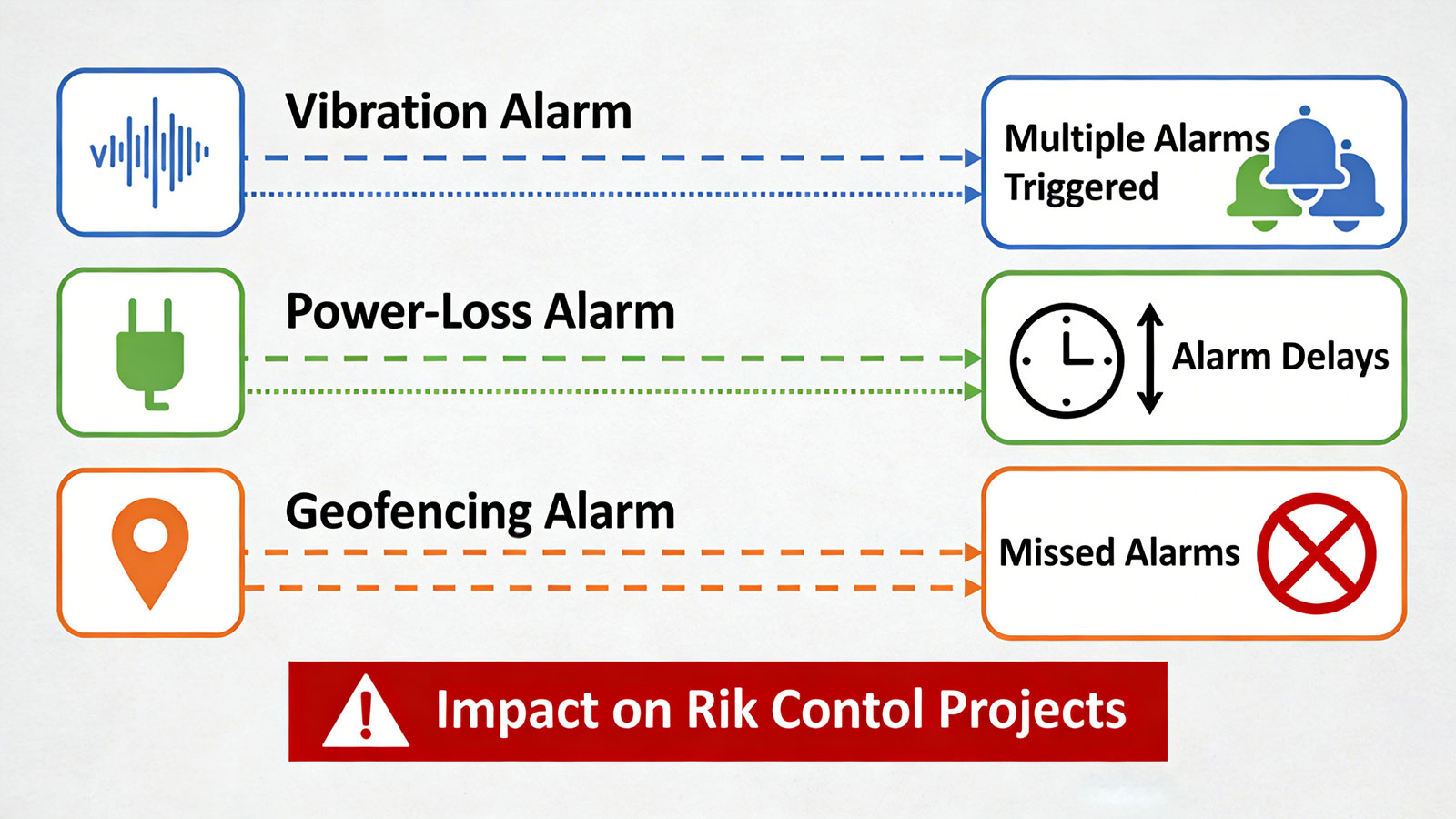
Inconsistent Alarm Logic
For instance, vibration, power-loss, and geofencing alarms—different devices often have distinct triggering conditions and reporting mechanisms. If the platform lacks a unified abstraction layer, the following issues may arise:
- Multiple alarms triggered by a single event
- Alarm delays
- Missed alarms
Such issues can have a significant impact on risk control projects.
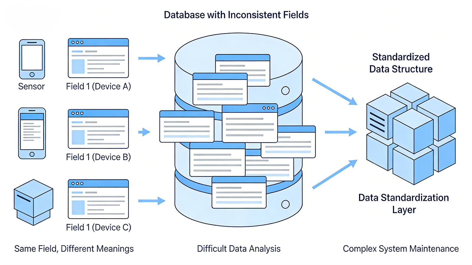
Inconsistent Data Field Standards
Many platforms fail to implement a unified data model during the design phase; instead, data fields from various devices are mapped directly to the database. The result is:
- The same field carries different meanings across different devices.
- Data analysis becomes difficult.
- System maintenance is complex.
Mature tracking platforms typically incorporate a data standardization layer to unify data from disparate devices into a standard structure.
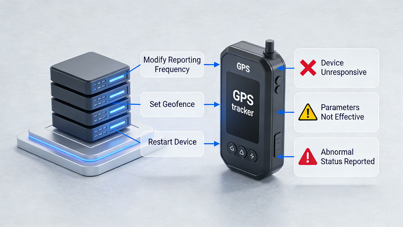
Incompatibility in Remote Device Configuration
Many GPS trackers support the remote issuance of commands—such as modifying reporting frequencies, setting up geofences, or restarting the device. However, command formats vary significantly across different devices; if the platform lacks the necessary adaptations, the following issues may arise:
- Commands are sent successfully, yet the device remains unresponsive.
- Configuration parameters fail to take effect.
- The device reports an abnormal status.
These issues severely compromise the efficiency of device operations and maintenance.
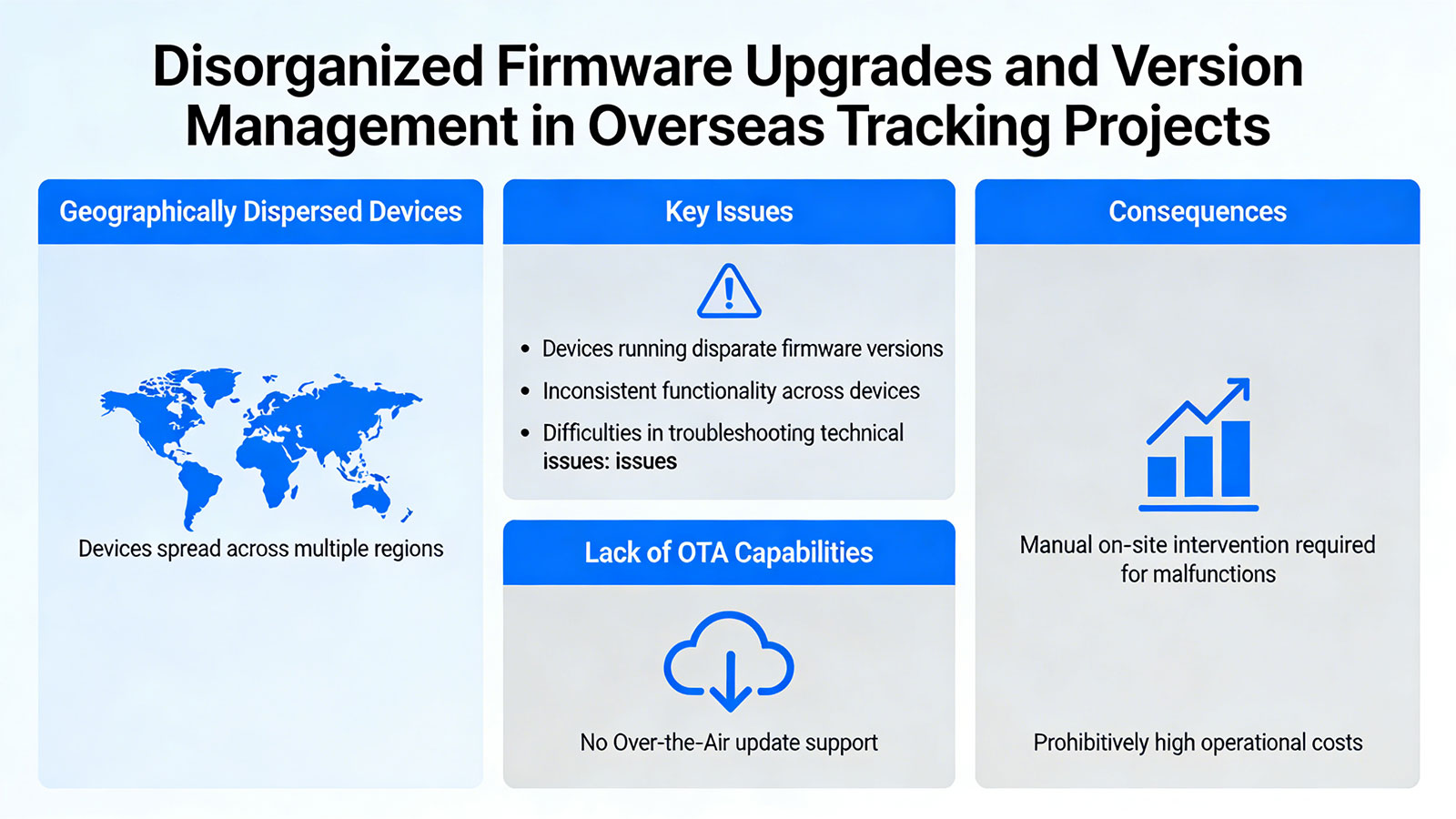
Disorganized Firmware Upgrades and Version Management
In overseas tracking projects, where devices are geographically dispersed, the absence of a unified firmware management mechanism frequently leads to the following issues:
- Devices running disparate firmware versions;
- Inconsistent functionality across devices;
- Difficulties in troubleshooting technical issues.
Furthermore, some platforms lack OTA (Over-the-Air) update capabilities entirely; consequently, whenever a device malfunctions, manual on-site intervention becomes the only recourse—a process that incurs prohibitively high costs.
These issues reveal that the core challenge for overseas GPS platforms lies not in the number of functions, but in their compatibility.
Many platforms operate well in the domestic environment because of the uniformity of equipment types, stable network environment, and consistent usage habits. However, the moment they enter overseas markets, the number of variables escalates significantly:
- A wider array of device brands;
- More complex communication protocols;
- Poorer network infrastructure;
- More diverse usage scenarios.
If a platform fails to address these factors at the architectural level, subsequent maintenance costs will become prohibitively high.
Therefore, when I work on projects, I usually remind clients that when choosing a GPS platform, it's not just about looking at the interface and functions, but about whether it truly has compatibility with multiple devices, multiple networks, and multiple scenarios. In overseas projects, what truly differentiates us is never the number of features, but rather the stability of the system.
-
Prev:
No More! -
Next:
GPS tracker connectivity: Does it need internet or SIM card? Share:


Return to list