





 Landscape
How does GPS work?
Admin 2024-07-22 11:52:00 1951
GPS satellites continuously send radio signals with time and position information in the sky day and night for reception by GPS receivers. Satellite time is generated by on-board atomic clocks. The position information of the satellite (satellite orbit parameters, also known as ephemeris) is sent to the satellite regularly by the ground control station, which is called "injection", and then broadcast to the user receiver through the satellite.

Use triangulation method to measure the distance between three or more satellites and the GPS receiver, and determine the position of the GPS receiver on the earth or in the sky from the distance. Since the three-dimensional position of the receiver needs to be determined, signals from at least three satellites must be received.
The distance is determined by measuring the time (interval) for the satellite signal to reach the receiver from the satellite. There is a period of time between the time when the signal is received by the receiver and the time when the signal is transmitted by the satellite. This time interval is usually called delay. The satellite and receiver generate the same pseudo-random code at the same time. Once the two codes are time synchronized, the receiver can measure the delay, multiply the delay by the speed of light, and get the distance.
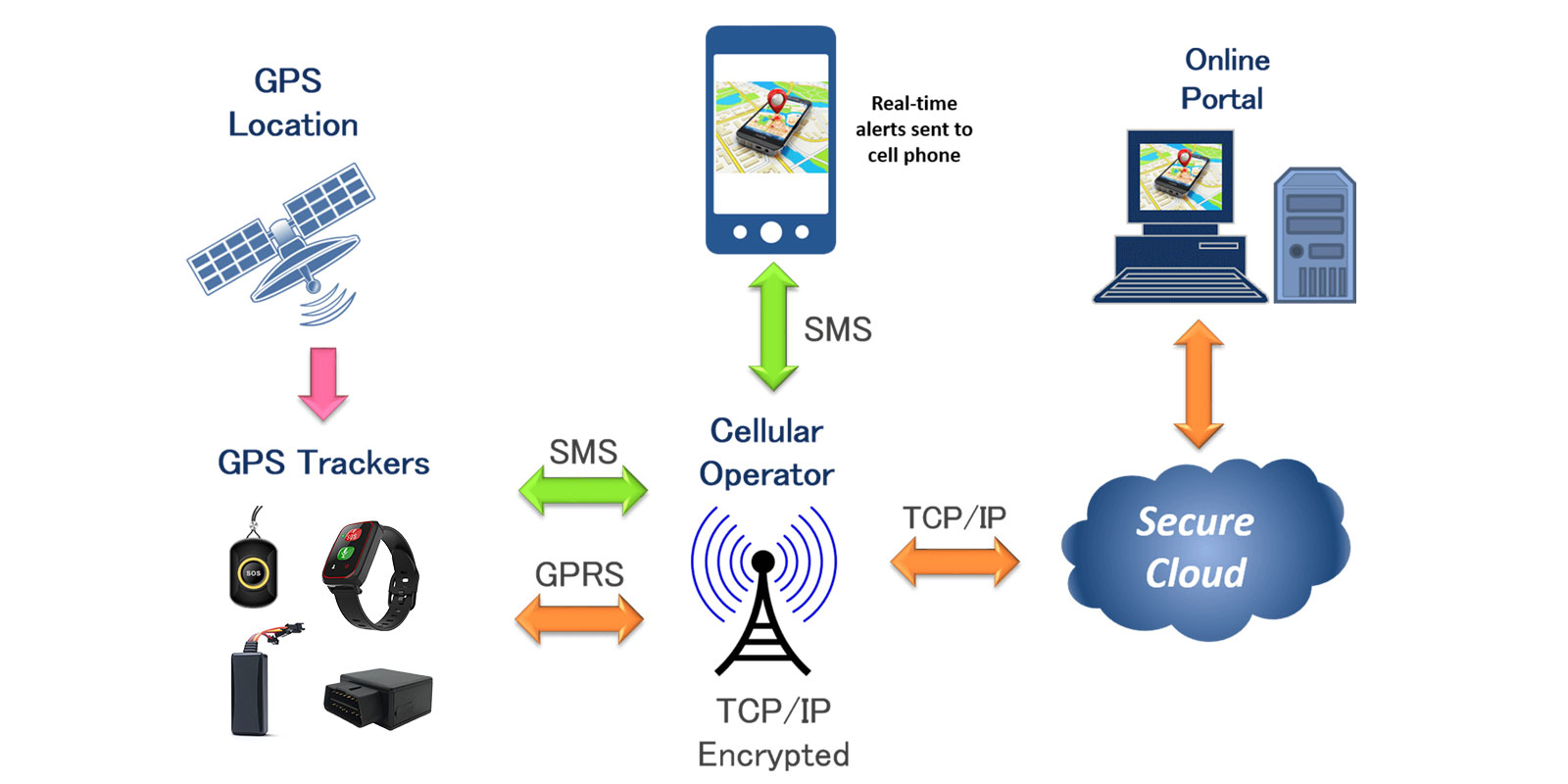
The satellite is equipped with an extremely high-precision atomic clock to ensure high accuracy of time delay measurement. However, the clock of the receiver is generally not atomic time, so the signal of the fourth satellite is often needed as a reference to determine the time, thereby correcting the distance error caused by the receiver clock.
During the operation of the GPS satellite, its orbit and atomic clock will change. The U.S. Department of Defense monitors its changes through the observation station network, and the main control station regularly injects relevant navigation parameters into the satellite in the form of navigation messages through the uplink communication link. and its error correction information, and is sent out along with the signal broadcast.

In order to correct various errors in the GPS system, the differential method can be used. Both the ionosphere and the neutral atmosphere (troposphere) in near-Earth space will cause GPS signal delays and lead to positioning errors. Using mathematical methods or models to process real-time measurement results can eliminate these errors, improve accuracy, and support a variety of GPS applications and services.
More details please check on article: https://www.huatenglobal.com/knowledge/4.html
Search
Previous
Comparison of 6 major indoor positioning algorithms, which will become the best one?
Next
GPS, LBS and WIFI positioning technologies of GPS Trackers | How to select a accurate tracking?
Latest News

In-Depth Analysis of Sleep Monitoring Technology in Wearables: From Algorithmic Principles to Accuracy

Wearable Tech for Better Health: A Deep Dive into Health Monitoring Features in Smartwatches

The Future of Fleet Management: Benefits of Vehicle GPS Tracking Devices

Revolutionizing Safety: How Smart GPS Watches Are Changing Lives for Kids and Seniors

10 Common Issues with GPS Positioning Management Platforms Customized by Chinese Companies Overseas Clients

Does All GPS Tracker Needs Internet or SIM Card?

Why the real barrier is "long-term project experience" rather than isn't hardware in GPS industry?
User Manual of Non-Removable GPS Tracking Bracelet C05 (Huatenglobal)

How to Find a GPS Tracker on Your Car? Comprehensive Guide (Updated 2025)
4G Smart Watch Location Algorithm (GPS, LBS and WiFi)

Discussion on the implementation of Huatenglobal smart watch fall alarm from Apple Watch fall algorithm

My grandma seems to have Alzheimer's, can you recommend a bracelet or smartwatch with GPS positioning?