





 Landscape
How Does GPS Tracker Works?
Admin 2026-04-04 879
Have you ever wondered how your cellphone's map, car navigation system or smartwatch accurately tells you "your current location"? Why is the location sometimes so accurate, but other times it "disappears" in a tunnel and basement? Behind this seemingly magical process lies a sophisticated "spatial-temporal dialogue." GPS (Global Positioning System) uses signals from distant space and complex mathematical calculations to pinpoint location information to the meter level.
As a GPS tracker manufacturer providing products and solutions to over 80 countries worldwide, we've thoroughly dissected the working principle of GPS in this article, isn't a textbook retelling, but rather the perspective of a hardware engineer with 10 years of experience: It will not only help you understand the principles but also make you realize — why seemingly identical trackers can perform so differently.
Ⅰ. What is GPS?
GPS stands for Global Positioning System, which developed by the United States in the 1970s, it's a satellite-based positioning, navigation, and timing system, and is the oldest and most widely used type of GNSS. Wherever you are on Earth, if you have a GPS receiver (such as a mobile phone, car navigation system, or GPS tracker), it can tell you your location, time, and speed.
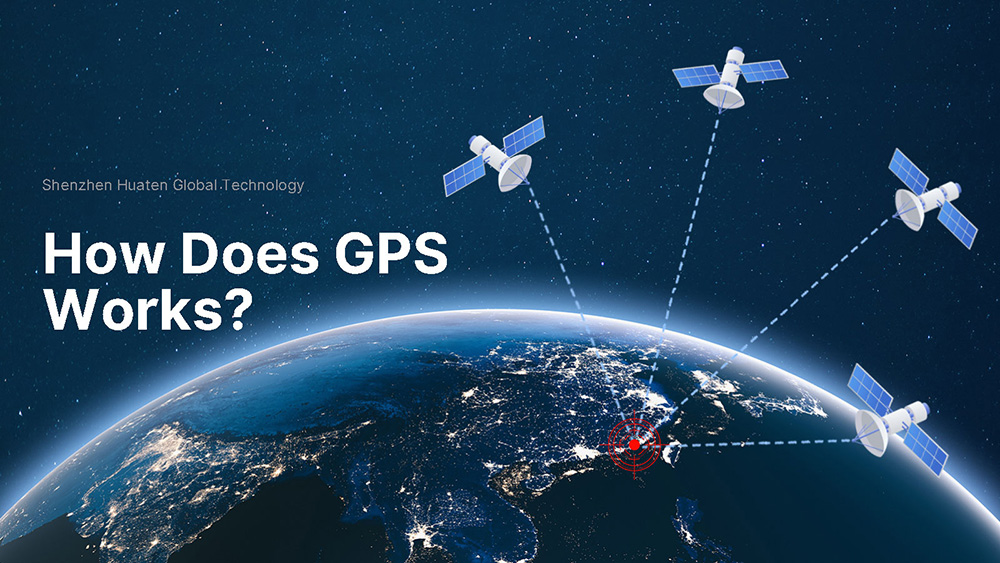
A complete GPS system is not just satellites in the sky, nor is it just the device in your hand; it is an infrastructure that is actually a whole consisting of three parts working together:
Satellites flying in the sky (space segment) – Ruler
It is a constellation of at least 24 satellites. These satellites operate at an altitude of about 20,200 kilometers above the ground, they orbit the Earth twice a day and broadcast their position and current time to the ground every moment, ensuring that at least 4 satellites can be "seen" simultaneously from anywhere on Earth.
From a professional perspective: The satellite's broadcast is extremely simple—"I am satellite PRN07, I am at [coordinates], and the current time is [atomic time]." This signal travels at the speed of light, and by the time it reaches the ground, it is as weak as -160 dBW, equivalent to a desk lamp 50 light-years away. Your tracker is designed to capture this signal in such an environment.
Ground-based monitoring station (ground control section) – Commander
If a satellite only broadcasts without calibrating, its clock will quickly drift. Monitoring stations, master control stations, and injection stations distributed around the world are responsible for monitoring whether the satellite is off course, correcting atomic clock errors, and refining orbital parameters, they manage the entire system like "commanders," and this corrected data is called ephemeris, which the satellite transmits along with its signals.
The locator holding in hand (user equipment part) - GPS Tracker
It refers to any device you have that can receive GPS signals: mobile phones, smartwatches, car navigation systems, drones, and the GPS trackers we produce, they are responsible for receiving signals and calculating your exact location.
But here's a key difference:
Consumer-grade chips only work when the signal is strong; our locators, however, need to maintain connectivity even under the metal roofs of large trucks, deep in underground garages, and in container yards. Therefore, we do more than just receive GPS signals; we do three other things:
GPS Assist: Utilizes base stations to pre-download ephemeris data, reducing cold start satellite acquisition time from 45 seconds to 3 seconds.
Inertial Navigation (INS) Position Calculation: After entering the tunnel, positions are calculated using accelerometers until GPS is restored.
Dual-Frequency Reception (Optional): L1+L5 dual-band reception directly eliminates ionospheric interference.
Understanding this will help you realize that GPS is public and free, but the real skill lies in being able to pinpoint a location even with a weak signal.
Ⅱ. How does GPS work? (Core principles)
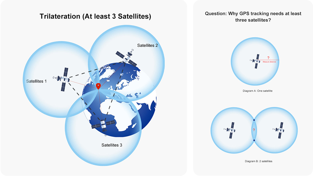
Behind this lies a fascinating mathematical game called the "trilateration method." GPS doesn't rely on cell towers or Wi-Fi routers, it uses only one simple physical law: Distance = Speed × Time.
Step 1: Satellites transmit signals
Each satellite broadcasts a message to the ground every millisecond: "This is SV12. My location is [40.6°N, 105.3°W, altitude 20200km], and the current time is 12:34:56.789000000!"
Step 2: Locator measures time difference
When your locator receives the signal, compare it with your quartz clock and find that it is 0.067 seconds late.
The speed of light is 300,000 kilometers per second, so:
Distance = 299,792.458 km/s × 0.067s ≈ 20,086 km
—This satellite is about 20,000 kilometers away from you.
Here's the challenge: the quartz clock in the locator isn't that accurate. If it's 0.001 seconds slower than the satellite's atomic clock, the distance error is 300 kilometers.
Step 3: Four satellite positioning – How to find a point using 4 rulers
Theoretically, three satellites can determine latitude and longitude (the intersection of two surfaces in three-dimensional space). However, this assumes a perfect receiver clock. In the real world, locator clocks are neither accurate nor expensive. The fourth satellite's task is not to measure distance, but to help you calculate the "current receiver clock error."
Therefore, the formula is: 4 satellites → 4 equations → Solve for 4 unknowns (x, y, z, receiver clock error).
Ⅲ. How Accurate is GPS Positioning?
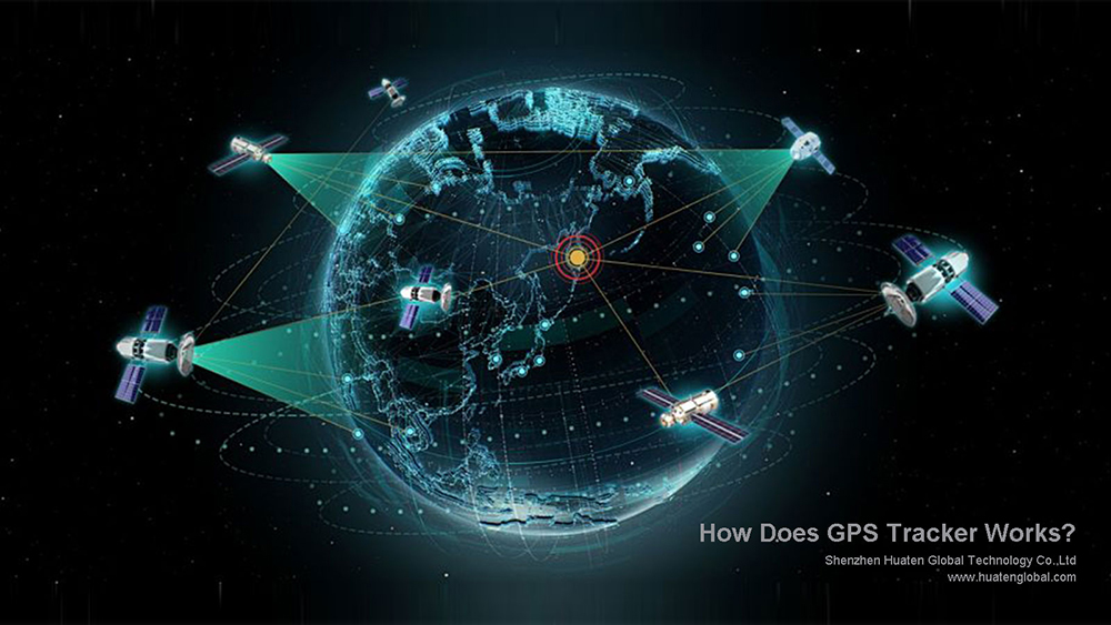
This is one of the most pressing concerns for enterprise customers when choosing a GPS tracking solution. The answer is not simply "±5 meters," but rather a probability distribution range that dynamically changes with the environment. Understanding this is a prerequisite for designing a reasonable IoT tracking solution.
3.1 Typical Accuracy Under Open Sky Environment
Accuracy Specifications | Values | Explanation |
CEP (Circular Error Probability) | 2.5-3.5 meters | 50% of the positioning points fall within this circle. |
2DRMS (Root Mean Square Error of 2 Distances) | 5-8 meters | 95% of the positioning points fall within this circle. |
RMS (Root Mean Square Error) | 3-5 meters | Average error level. |
In layman's terms: Under ideal conditions, there's a 50% chance that the location you see is less than 3 meters from the actual location, and a 95% chance that the deviation is less than 8 meters. The remaining 5% may have an error exceeding 8 meters.
3.2 Actual Performance Under Different Environments
Environment | Typical Accuracy (CEP) | 95% Confidence Interval | Influencing factors |
Open suburbs, sea, desert | 2-3 meters | <5 meters | Unobstructed view, good satellite geometry |
Suburban roads, residential areas | 3-5 meters | <10 meters | Sparse trees, low-rise buildings |
City streets (with buildings on both sides) | 5-10 meters | <20 meters | Partial sky obstruction, multipath propagation |
High-rise canyons (CBD) | 10-30 meters | >50 meters | Severe obstruction, signal reflection |
Indoors, tunnels, underground parking garages | Unable to locate | - | No visible satellite signal |
Huatenn Global's value lies in our deep understanding of the physical boundaries of GPS and our use of systems engineering to keep its imperfections within acceptable business limits, ensuring that positioning data truly serves your business decisions. Meanwhile, as an enterprise customer, you should focus on:
The device's performance in your actual deployment environment,
The supplier's engineering optimization capabilities (antennas, algorithms, fusion), and
How the platform processes and presents the imperfect raw data.
Ⅳ. 12 Core Factors Affects Position Accuracy
(1). Sky Visibility (Most Important)
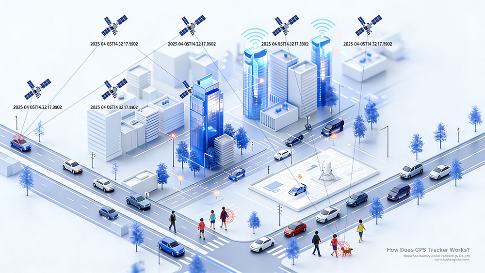
GPS signals cannot penetrate solid obstacles. A device needs to "see" at least four satellites to locate itself. Tree leaves overhead, tall buildings on either side, and metal on car roofs can significantly affect the number of available satellites and signal quality.
(2). Multipath Effect
After a signal is reflected by a building, it reaches the receiver via a longer path, causing the calculated position to drift and deviate from the actual location, this is the main reason for decreased accuracy in urban environments, causing a deviation of 10-50 meters.
(3). Satellite Geometric Distribution
Even with a sufficient number of satellites, their spatial distribution is crucial. Positioning is most accurate when satellites are distributed in four directions; when they are clustered together, errors are amplified and accuracy decreases.
(4). Atmospheric Delay
The ionosphere and troposphere delay signal propagation. Although multi-frequency reception and model correction are used, errors of several meters can still occur during periods of intense solar activity or drastic weather changes.
(5). Receiver Hardware Quality
Indicators | Consumer Grade | Industrial Grade |
Channel Count | 22-32 | 50-72 |
Sensitivity | -162dBm | -167dBm |
Multipath Suppression | With algorithm | With algorithm |
Interference Resistance | Weak | Strong |
(6). Antenna Design
The antenna is the "ear" of GPS tracker. The gain pattern, grounding design with the motherboard, and the presence of surrounding metallic interference all directly affect actual reception performance.
(7). Ephemeris Timeliness
Ephemeris data is valid for 2-4 hours. The GPS devices that have been powered off for an extended period and then restarted need to re-download the ephemeris, during which time accuracy may decrease.
(8). Dynamic Stress (Relativistic Effects)
High-speed satellite movement (>80 km/h) causes clock drift. The Doppler effect complicates signal processing and may lead to lag or jumps. Note: The satellite has been pre-calibrated; the receiver does not require processing.
Note: The satellite moves at a speed of 14,000 km/h. According to special relativity, its clock runs slower than the ground; however, due to weaker orbital gravity, according to general relativity, its clock runs faster than the ground. These two factors cancel each other out, resulting in a net gain of 38 microseconds per day. Without calibration, this 38 microseconds accumulates into an 11-kilometer positioning error per day—GPS satellites are pre-calibrated with frequency offsets to compensate for this.
(9). Satellite Health Status
Individual satellites may be marked as "unhealthy" or under testing, but there is a delay in the device acquiring this information.
(10). Electromagnetic Interference
Electromagnetic interference from the vehicle's ignition system, motor, and high-power equipment may affect the normal operation of the car's GPS receiver.
(11). Difference Between Warm Start and Cold Start
Then the device is first powered on (cold start), it needs to re-scan for satellites, and the satellite geometry may not be optimal, accuracy will improve after a period of stable operation. What is Cold Start, Warm Start and Hot start? How how affect location accoracy?
(12). Intentional Interference/SA Policy
Although the U.S. government abolished the SA (Selective Availability) policy in 2000, the fundamental difference in accuracy between civilian and military signals still exists.
Ⅴ. How Does a GPS Tracker Work?
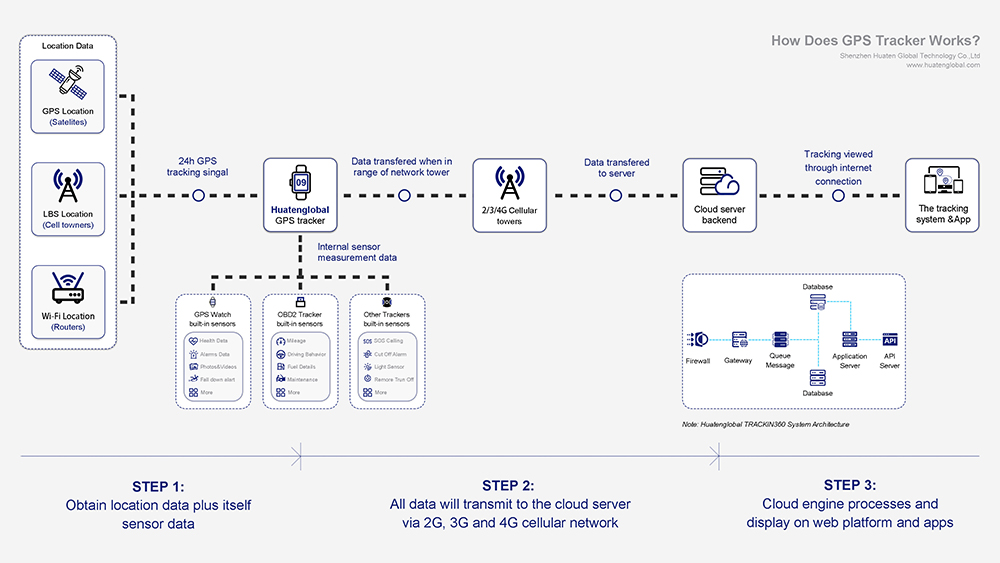 The workflow of a real GPS locator is as following:
Step 1: The GPS device acquires latitude and longitude data from satellites
Insert the SIM card into the device, turn it on, and activate it. The device's built-in GPS module will begin searching for satellite signals, it will lock onto at least four satellites and calculate latitude, longitude, speed, heading, and altitude. This process takes varying amounts of time, from 2 to 45 seconds, depending on the situation and environment. "Why do some locators not need to obtain latitude and longitude data from satellites?", Click to know the different type of tracker on: How to Choose The Right Tracker?
Step 2: Transmit latitude and longitude data to the server via cellular network
The acquired satellite latitude and longitude data, along with data from the device's built-in sensors (different types of devices have different built-in sensors, such as GPS watch health data, vehicle locator ACC/voltage/vibration status data, OBD2 locator car fault codes, driving behavior, mileage and fuel consumption reports, etc.), plus a timestamp, are transmitted to the cloud server via 4G Cat.1/NB-IoT/5G cellular networks. "Why the GPS tracker need a SIM card?" click to view on: Does all GPS tracker need a SIM card?
Step 3: Parsing and displaying data on the Web and App
The cloud server parses the received data according to the protocol standards and transmits it to the web-based management platform for display via 4G Cat.1/NB-IoT/5G, the Android and iOS apps retrieve the corresponding data through the cloud server's API interface and display it to end users in real-time. We provide free management software; please click to view the article: Free Tracking Platform and Apps Introduction.
Further Reading: How to Test a GPS Tracking Device? Please click to view the article: Testing and Troubleshooting Guide.
Ⅵ. Advantages and Disadvantages of GPS Position Technology?
Q: "Since GPS is so good, why doesn't my GPS tracker have signal in the parking garage?"
Q: "Why does my phone's location sometimes drift to the next street?"
Q: "Why does my newly purchased GPS device keep showing as offline and unable to connect to my mobile app?"
Q: "Why is my GPS tracker location not always accurate?"
As a manufacturer of GPS tracker hardware for 10 years, we have to be admitted: GPS tracking is not perfect, but how to compensate for its imperfections is the real watershed moment for a product. To answer these questions, we need to first understand the advantages and disadvantages of GPS positioning technology.
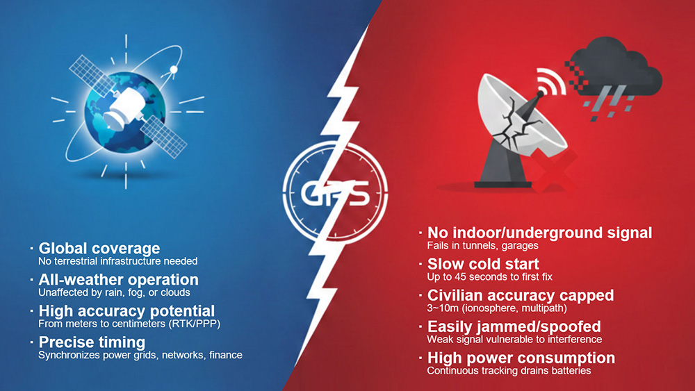
6.1 Four (4) Core Advantages of GPS Positioning Technology
Advantages | Detailed Description | Remarks |
Global coverage, no infrastructure required | Existing infrastructure: No need to build it yourself Zero marginal cost: Signal is free and open True globalization: Usable in over 200 countries | This is why international logistics fleets, deep-sea fishing, and cross-border freight rely almost 100% on GPS—it doesn't care which country you're shipping from. |
All-weather, all-time | Heavy rain, dense fog, sandstorms: Signal penetration is effortless. Day and night, polar day and polar night: Satellite broadcasts as usual. Operating frequency band (L1: 1575.42MHz): Extremely insensitive to cloud cover and rain attenuation. | Optical positioning (visual SLAM, star sensors) becomes ineffective in rain and fog; base station positioning requires the location to be within signal coverage. |
Accuracy potential (Commercial: Meter-level Accuracy) | Single-point positioning (L1): Accuracy 3-10 meters, suitable for conventional vehicle tracking and personnel monitoring; Differential GPS (DGPS): Accuracy 0.5-1 meter, suitable for precision agriculture and waterway navigation; RTK carrier phase: Accuracy 1-5 centimeters, suitable for drone spraying and machinery control; Static PPP: Millimeter-level accuracy, suitable for crustal deformation monitoring and dam observation. | GPS isn't "inaccurate"; it's about how much you're willing to pay for accuracy. How do I choose the right locator for my system? |
Time synchronization | Financial Systems: Timestamps must be aligned at the nanosecond level to prevent high-frequency arbitrage. 5G Base Stations: TDD mode requires network-wide μs-level synchronization. Smart Grid: Fault recorders must have a unified timescale; errors greater than 1ms will lead to errors in accident analysis. | Many customers purchase locators not to see where the vehicle is, but to collect the vehicle's arrival time—cold chain transportation requires temperature control records accurate to the second. |
6.2 Five (5) Major Disadvantages of GPS Positioning Technology
Disadvantages | Detailed Description | Common Solutions | Remarks |
The signal has extremely weak wall-penetrating ability—it fails directly indoors and in tunnels. | Reinforced concrete: Attenuation 30~40dB Metal carriage: Attenuation 40~50dB, almost completely shielded Underground space: Completely undetectable | Long tunnels: 6-axis inertial navigation IMU, position estimation, error ≤3%, automatic calibration upon exiting the tunnel. Underground parking garages: Bluetooth AOA positioning or WiFi fingerprint, accuracy 1-5 meters. Metal containers: External magnetic antenna, attached to the door gap to introduce signal. | 1575MHz belongs to the L-band, which is characterized by line-of-sight propagatio—similar to the beam of a flashlight, it is blocked by walls. |
Slow initial location (cold start TTFF) Ordinary consumers find it hard to understand: why does mobile phone navigation provide a location immediately upon opening, while professional GPS trackers take 30 seconds to boot up? | The reason lies in the memory of location and time. Warm start: Remembers the satellite position when the device was last powered off, locating within 5 seconds. Cold start: Complete amnesia, requires a full-band search and ephemeris download, 45 seconds is the industry average. | AGPS Assist: Utilizes base stations to pre-download ephemeris data, compressing cold start time to 8-15 seconds. Timed Self-Wake-Up: The device remains powered on 24/7, automatically updating ephemeris data every morning to avoid cold starts. | Please refer to the article: What are GNSS cold start, hot start, and warm start? |
Civilian accuracy is limited by policy and physical environment | Policy Limitations of : GPS was originally designed with Selective Availability (SA) interference, intentionally reducing accuracy to 100 meters; the civilian L1 frequency still only has coarse acquisition codes (C/A codes), and a single frequency cannot eliminate ionospheric errors in real time. Physical Bottlenecks: Multipath effects (urban canyons, under viaducts); Satellite geometry (DOP value); Atmospheric delay residue, etc. | Dual-frequency reception (L1+L5): Optional for high-end models, directly measures and cancels ionospheric delay, improving accuracy to 1-meter level. Suppressed-radius antenna: Physically suppresses ground-reflected waves, reducing drift by 60% under elevated structures. Map matching algorithm: Attaches positioning points to the road network grid, solving the "driving in a river" problem. | Please refer to the article: What are the Physical Bottlenecks? |
Vulnerable to interference / deception This is a legacy issue of GPS as a military technology. | Unintentional interference: Car chargers and low-quality LED headlights can generate harmonics that overpower the GPS signal. Intentional interference: A low-power jammer costing only a few tens of yuan can disable devices within a 200-meter radius. Spoofing attacks: Forging GPS signals to cause receivers to calculate incorrect latitude and longitude (e.g., forcing a drone to land at a false location). | Radio frequency interference: Hardware-wise, a SAW bandpass filter + LNA low-noise amplifier is used. Spoofing attacks: Algorithm-wise, signal encryption authentication and carrier phase continuity detection are implemented. Signal loss: A fusion positioning scheme is adopted, namely inertial navigation hold-up + 4G/WiFi assisted positioning. | If you are concerned about your assets being maliciously dismantled or blocked, we recommend the BDS-3 short message device. |
Heavy Power Consumption Issue Difficulty in maintaining battery life during continuous positioning | GPS receivers need to continuously track satellite signals during operation; the RF front-end and correlator calculations are major power consumers. | Optimization from Intelligent sleep mode, dynamic upload interval adjustment, solar power supply, lower power consumption chips, etc. | Please refer to article on: What is the battery life for GPS tracking devices? |
Ⅶ. How does Mainstream GPS Tracking Devices Address the Shortcomings of GPS Positioning?
7.1 You've probably encountered these scenarios
When your car's GPS locator enters a tunnel, the vehicle icon on the screen gets stuck at the entrance and doesn't move;
After exiting the tunnel, the icon suddenly moves hundreds of meters—its trajectory looks like beads on a broken string;
Or, your phone's navigation frequently drifts under overpasses;
Even though you're driving on the main road, the location keeps jumping to the side road, and the voice prompts start to malfunction, confusing left and right.
7.2 The fact of these problems is: no single positioning technology is perfect
GPS can cover the globe, but it can't penetrate reinforced concrete;
Inertial Navigation can make short-term calculations, but it drifts over time;
WiFi positioning works indoors, but it becomes ineffective outside.
7.3 It cannot simultaneously meet the following three ultimate requirements
Full coverage: indoor + outdoor + underground + sky
High precision: meter-level or even centimeter-level
Low cost/low power consumption: suitable for large-scale commercial use
Therefore, the currently mainstream GPS trackers are using multi-mode positioning technology or fusion positioning technology, which integrates multiple positioning technologies such as GPS, LBS, WIFI and Bluetooth into one device to achieve accurate positioning even in scenarios without GPS.
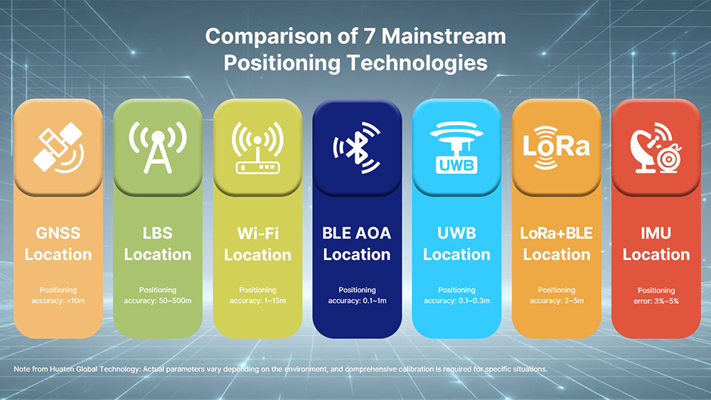
Ⅷ. Comparison Table of Positioning Technologies
Technologies | Coverage Area | Accuracy | Advantages | Disadvantages | Applicable Scenarios | Typical Scenarios |
GNSS (GPS, Beidou, etc.) Location | Global (Open outdoor skylight coverage) | 3~10 meters (single point) | ✅ Global coverage, no ground infrastructure required ✅ All-weather, unaffected by weather ✅ Free civilian signal | ❌ Completely unusable indoor, in tunnels, under elevated structures ❌ Slow cold start (45 seconds) ❌ Susceptible to interference/spoofing | Outdoor mobile asset tracking; Vehicle navigation and fleet management; Drones/ships/agricultural machinery | 1️⃣ Real-time trajectory monitoring of ride-hailing/logistics vehicles 2️⃣ Electronic fence parking for shared bicycles 3️⃣ RTK (Real-Time Kinematic) harvesters for precision agriculture |
LBS Location | Urban&Rural Areas (with cellular network signal) | 50~500 meters | ✅ Usable both indoors and outdoors ✅ No additional hardware required ✅ Zero cost (reuses 4G/5G) | ❌ Extremely coarse accuracy ❌ Dependent on operator base station density ❌ Unable to distinguish floors | Rough location tracking of mobile app; Network optimization and coverage analysis; Emergency rescue positioning | 1️⃣ Obtain city-level location upon first opening of the food delivery app 2️⃣ Detect blind spots in carrier network base station coverage 3️⃣ Low-power general positioning for senior-friendly phones/children's watches |
WiFi Location | Indoor (AP coverage area) | 1~15 meters (Positioning accuracy depends on AP/beacon density) | ✅ Utilizing existing WiFi hotspots ✅ Good indoor coverage ✅ No dedicated positioning base station required | ❌ Fingerprint collection, maintenance required in advance; ❌ Signal strength is greatly affected by environmental changes; ❌ WiFi scanning needs to be enabled | Shopping mall/airport navigation; Office building staff attendance; Hospital equipment tracking. | 1️⃣ Indoor navigation for finding stores in large shopping malls 2️⃣ Real-time inventory of medical equipment in smart hospitals 3️⃣ Visitor heat map analysis for convention centers |
Bluetooth AOA Position | Indoor (Partial coverage) (10-50 meters /base station) | 0.1~1 meters | ✅ Sub-meter level high precision ✅ Relatively simple deployment (only requires an array antenna base station) ✅ Low terminal cost | ❌ Requires dedicated array base stations ❌ Small coverage area ❌ Significant signal attenuation due to metal obstructions | High-precision indoor positioning;
Factory/warehouse personnel and material positioning; Exhibition hall/museum guided tours | 1️⃣ Anti-theft tool/part positioning system in automotive assembly workshops 2️⃣ Anti-theft wristbands for newborns in top-tier hospitals 3️⃣ Interactive exhibits for art gallery visitors |
UWB (Ultra-Wideband) Position | Indoor/Regional (50-100 meters /base station) | 0.1~0.3 meters | ✅ Centimeter-level precision ✅ Extremely strong resistance to multipath interference ✅ High real-time performance (100Hz+) | ❌ High hardware cost ❌ Requires dense deployment of base stations ❌ High power consumption | Industrial automation (AGV); Personnel positioning in judicial prisons/tunnels; Sports event trajectory tracking. | 1️⃣ AGV/Forklift Automated Guidance and Collision Avoidance 2️⃣ Safety Positioning of Personnel in Coal Mines/Tunnel Construction 3️⃣ Movement Trajectory Analysis of Football/Basketball Players |
LoRa + BLE Beacons Position | Wide Area/Campus Area (1-10 kilometers/ gateway) | 2~5 meters | ✅ Extremely wide coverage; one gateway can cover several square kilometers. ✅ Ultra-low power consumption (button battery lasts for years). ✅ No SIM card/data charges required. | ❌ Requires deployment of BLE beacons (fixed anchor points) ❌ Poor real-time performance (minute-level updates) ❌ Lower accuracy than UWB/AOA | In scenarios where there is no 4G signal, no WiFi coverage, and it is impossible to set up dense base stations, but large-area asset tracking is required. | 1️⃣ Livestock farming/herd tracking 2️⃣ Coarse-grained inventory of container yards 3️⃣ Static asset monitoring |
IMU (Inertial Measurement Unit) | Global (Short-term independent) | 3%~5% Error (Difference over time) | ✅ Fully autonomous, independent of external signals ✅ Extremely high output frequency (1000Hz) ✅ Measurable attitude and heading | ❌ Errors accumulate over time, making independent positioning impossible for extended periods. ❌ Requires initial position calibration. ❌ Affected by temperature drift. | Tunnel/underground parking dead reckoning; UAV/robot attitude control; Vehicle integrated navigation (fusion). | 1️⃣ Vehicle position estimation in long tunnels (tunnel exit calibration) 2️⃣ Indoor mapping and path planning for robotic vacuum cleaners 3️⃣ Smartphone pedometer/orientation sensor |
Note: The accuracy data are engineering experience values based on open environments or typical deployment conditions. Actual performance is affected by deployment density, environmental interference, and hardware version.
There is no standard answer to which technology route to choose; only the "optimal solution for the scenario" can be found after fully understanding the real-world application. To determine which technology solution you need, please read the article: GPS tracker classification and how to choose a suitable tracker?
Search
Previous
Next
Latest News
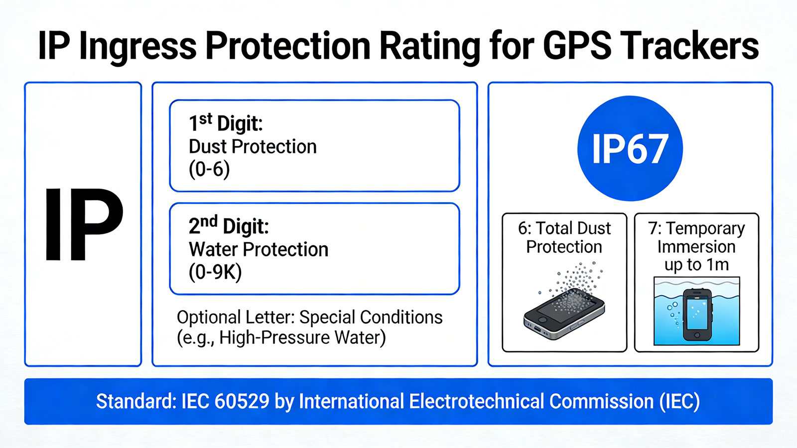
IP Protection Ratings is Not Permanent: Is Your GPS Tracking Device Truly Waterproof and Dustproof?
Is that Smartwatch Health Monitoring Medical Grade? - Focus on Trends, Not Medical Grade Disease Diagnosis Criteria
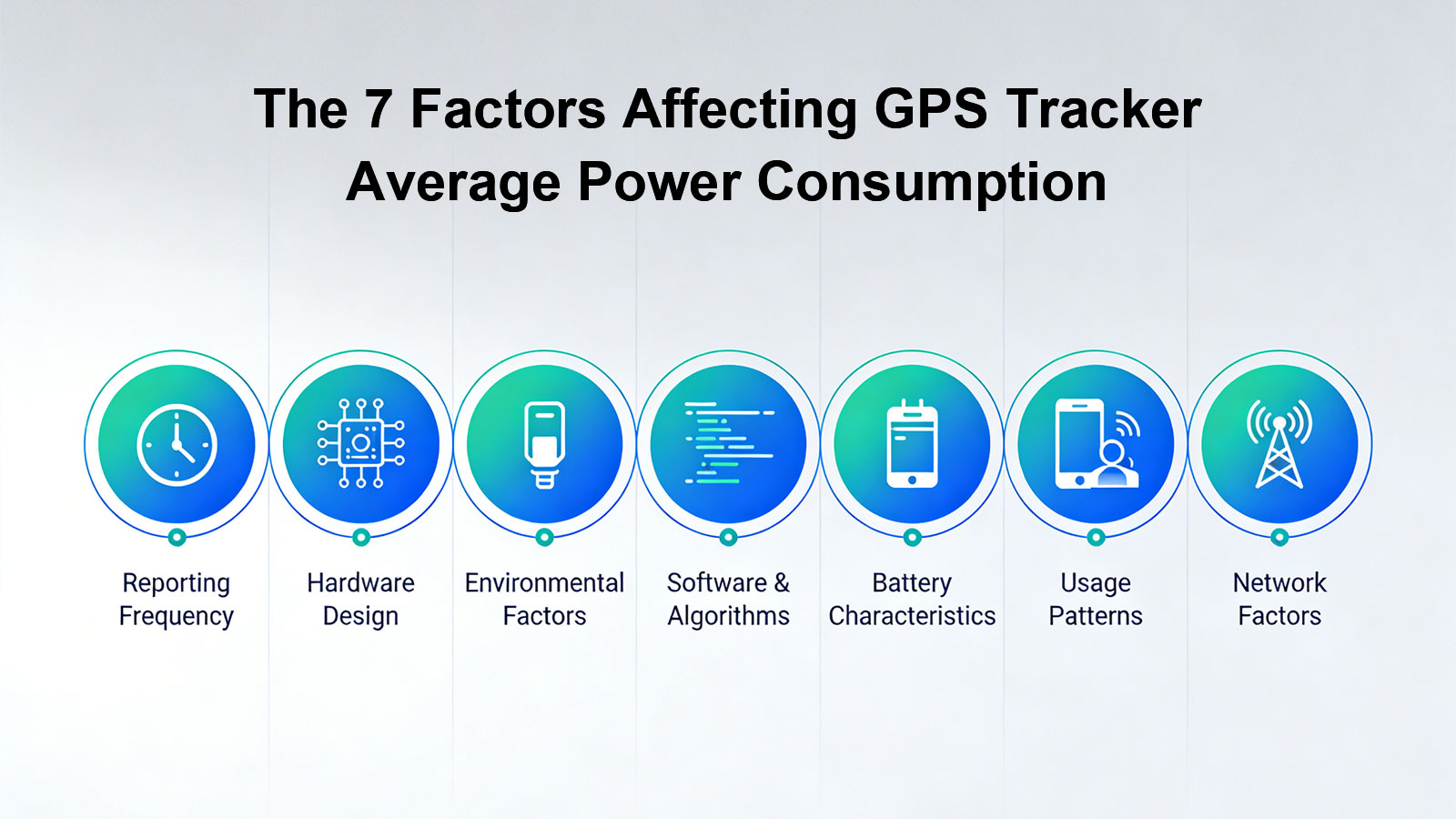
Battery Life Decoding: Seven Key Factors Affecting Your GPS Tracker Battery Duration
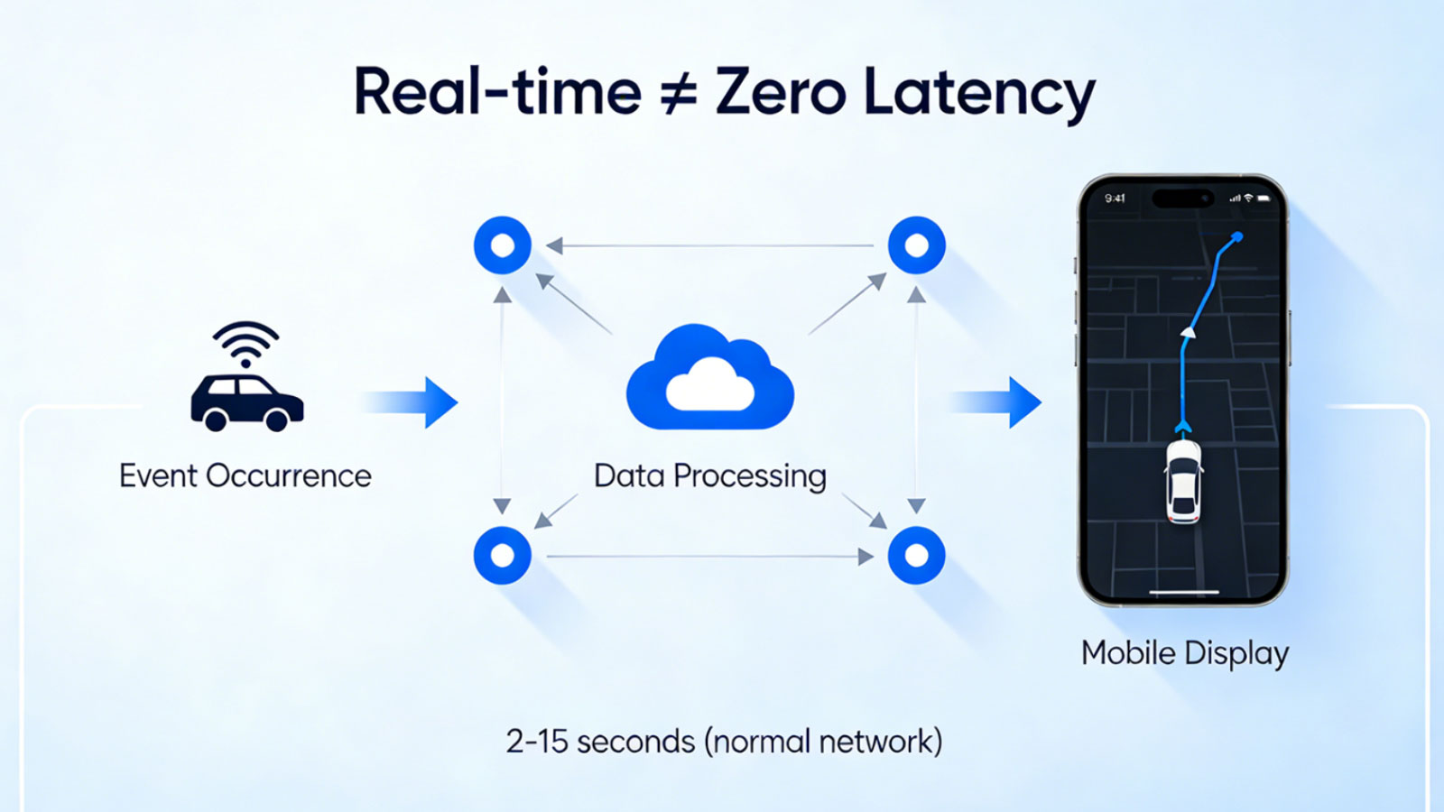
Is GPS Positioning Truly Real-Time? — The Truth About "Real-Time" GPS Tracking
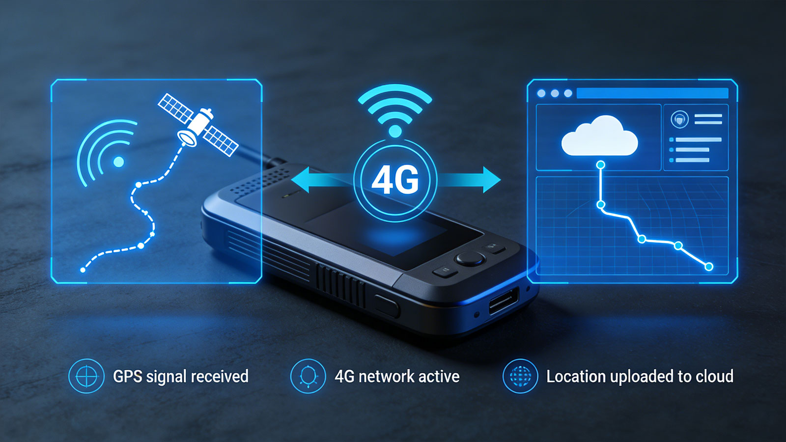
Beyond Connectivity: What Your Tracker Can and Cannot Do When Cellular Networks Disappear?